ALL ABOUT TOPOGRAPHICAL SURVEYS
If you landed here, you are one of these kinds of visitors:
1. You are in the process of planning a project and require a topographical survey expert.
You are browsing the web to gather more information about surveyors in Ireland. If this is the case, drop us an email and provide the details of your project. Step by step, we’ll define the best quote for you.
2. Curiosity led you here. Then keep reading to learn everything you need to know about topographic surveys.
At Land and Aerial Surveys, we have a combined experience of over 30 years in gathering topographical and hydrographic survey data using the most up-to-date robotic total stations, scanners, GPS and surveying software to ensure a fast and cost-effective field-to-finish solution. The final processed data can be supplied in various formats.
Our client's needs vary from a one-off home boundary survey to large surveys for the purpose of construction design.
WHAT IS A TOPOGRAPHICAL SURVEY AND DO I NEED ONE?
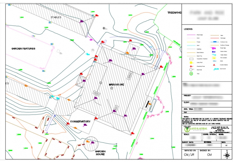
A topographical survey is a tool that accurately represents all the features people can find in a property: natural or artificial items. Basically, it’s a 2D/3D process that maps all those elements that are relevant to a construction or development project, and it depicts their location, height, and size.
Examples of natural items that people represent in the final product are trees, bushes, slopes, land depression, etc.
The artificial category, on the other side, comprehends walls, fences, bridges, and street furniture like litter bins, benches, etc.
Topographical surveys in Ireland are usually fixed to the Ordnance Survey National Grid and Datum.
Before undertaking any construction or development project, it is advisable to perform a topographical survey to identify any various features and levels of the site. This process is undertaken by using GPS, Total Station and laser scanning.
Points are surveyed in 3D to facilitate ground models for visualisation and design purposes. Gathering the right information at an early stage of a project will generally save time and reduce costs throughout the duration of the project.
A topographical survey is a fundamental tool for many professionals: architects, designers, and engineers. Most people link this tool to new constructions, but the topographical survey is a compulsory requirement for other kinds of projects, such as remodeling, drainage, and road improvements.
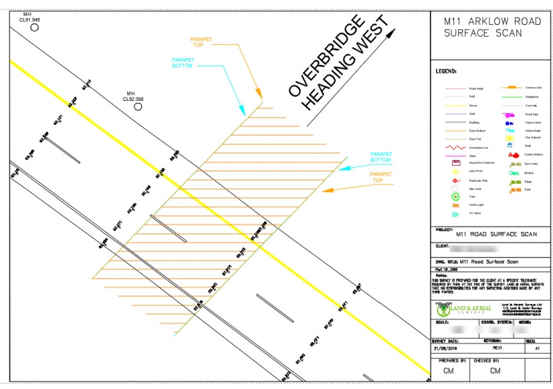
Topographic Survey Example:


HOW MUCH DOES A TOPOGRAPHICAL SURVEY COST IN IRELAND?
Are surveyors in Ireland expensive?
According to the Society of Chartered Surveyors Ireland, the cost for an on-site survey ranges between €500 and €1000 per day. And the land survey is only the first step in the process.
All the data collected during the on-site survey requires time to be processed and drafted by professionals. Usually, one day of on-site survey is equal to one day in the office for data elaboration and design with CAD software.
There are many elements that impact the survey costs. For example, the quote may vary according to:
- Size of the land to survey
- Detailed degree required by the customer
- Accuracy degree required by the customer
The larger the plot is, the greater the data to collect will be. At the same time, more accurate and detailed drawings will require more hours to be processed. A survey company will estimate the amount of data that you require and will make a quote based on the number of days needed to record and process all the data.
HOW TO REDUCE THE SURVEY COSTS?
Yes, there is a way to keep your survey within the budget. We suggest considering the elements below.
1. Size
Think about the size of the land to be surveyed. Do you need to survey all of your property? Is there the possibility that part of your property is not going to be involved within the scope of work?
2. In-depth analysis A parameter that will help you save money is the degree of detail required. Are there certain features that have not the same relevance to your project? An example would be overgrown vegetation areas of the land in question. This can be time-consuming for land surveyors to gain access to and will result in additional costs to your project.
3. Professional
Know-how is non-negotiable. Make sure you hire the right surveyor, always check the company credentials before getting in touch with them. At the same time, check your quote after they send it to you and make sure the surveyor does not charge extra costs.
4. Request samples
Ask the professional to send previous works, like drawings in pdf & cad format.
OUR OFFER
If you are looking for a surveyor in Ireland, try our services!
Land and Aerial Surveys offer you complete assistance in the development of your topographical requirements, and our team can provide the support your architects and developers need.
With more than 16 years of expertise, we will guide you step by step for your topographical needs.
Land and Aerial Surveys can advise you on the best survey options for your requirement and a detailed breakdown of costs.
Drop us an email, and tell us more about your project requirements. We will be happy to share our previous work with you!
